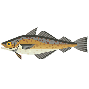
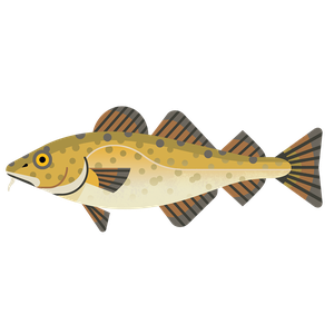
Common ling
Molva molva
What to check for
Location
Northeast Atlantic and Arctic Ocean
Technical location
Atlantic, Northeast, Bay of Biscay, East Greenland, Irish Sea, Porcupine Bank, English Channel, Bristol Channel, Celtic Seas, West and Southwest of Ireland, North Sea, North of Azores, Portuguese Waters, Rockall, West of Scotland, Skagerrak, Kattegat, Transition Area, Baltic Sea
Caught by
Bottom trawl (otter)
Rating summary
Ling in the northeast Atlantic and Arctic Ocean is data limited. There is no concern for the stock size, but fishing pressure may be too high. Catch limits for ling in the northeast Atlantic and Arctic Ocean have been set significantly higher than the scientific advice in recent years. Management is not therefore following scientific advice. Just over a third of Northeast Atlantic and Artic Ocean ling are caught by trawl. Which is likely to cause some damage to the seabed. Most trawling catches are bycatch from Scottish vessels.Updated: August 2024
Technical consultation summary
Common Ling in the Northeast Atlantic and Arctic Ocean are data limited. There is no concern for the biomass, but there is concern for fishing pressure. From 2018-2022 catches were on average 22% higher than the advice. Additionally, fishing pressure is above FMSY proxy. In the absence of any other information about fishing mortality, this indicates that there could be concern for the fishing pressure. Total Allowable Catch (TACs) have been set significantly higher than the scientific advice in recent years. Management is not therefore following scientific advice. Just over a third of Northeast Atlantic and Artic Ocean ling are caught by trawl. Which is likely to cause some damage to the seabed. Most trawling catches are bycatch from UK (Scotland) vessels. Most ling catch for these regions is within subareas 4 and 6. The majority of bottom trawl catch is bycatch from UK vessels in subarea 6. While the major ling targeted fishery is Area 4.a, which have Norwegian longliners fishing around Shetland and in the Norwegian Deep, with additional Norwegian longline fisheries in subarea 6.
How we worked out this Rating
Ling in the northeast Atlantic and Arctic Ocean are data limited. There is no concern for the biomass, but there is concern for fishing pressure.Route 2 scoring has been applied to this rating owing to the lack of reference points for fishing pressure and biomass. Ling is considered to have medium resilience to fishing pressure.Stock assessments are carried out by the International Council for the Exploration of the Sea (ICES). The most recent assessment was published in 2023 using data up to 2022. The next assessment is expected in 2025.In general, 90% of ling landings are from the North Sea and west of the UK (areas 4 and 6), although in 2022 this increased to around 95%. Biomass in these areas appears to have been increasing since the early 2000s. It is measured using catch per unit effort (CPUE), which is the abundance of ling caught (in kg) for every 1,000 hooks put out by the longline fleet. From 2016-2018 this averaged 153kg, and increased to 156kg for 2019-2020, remaining stable at 155kg for 2022. This increase, in addition to the relative biomass being well above the reference point for biomass (Itrigger), indicates that there is no concern for the biomass.ICES notes that since 2008 the total catch (except for 2020) has been higher than advice. From 2018-2022 catches were on average 22% higher than the advice. Additionally, fishing pressure is above FMSY proxy. In the absence of any other information about fishing mortality, this indicates that there could be concern for the fishing pressure.ICES advises that when the MSY approach is applied, catches should be no more than 13,317 tonnes for 2024 and 2025. This is an 12% decrease on the previous year.Advice based only on catch data, such as the CPUE data used here, can be misleading. This has happened with other stocks, e.g. when Newfoundland cod was incorrectly thought to be increasing. Therefore, there is some uncertainty with this assessment. Usually, around 10% of landings are from the Celtic Seas (area 7), although in 2022 this decreased to just over to 3%. Surveys in this area and in the Bay of Biscay (area 8), suggest that biomass is declining. This might indicate that there are 2 stocks in the different areas, or that warming seas in the south of the ling's range are unfavourable for this species. ICES indicates that the data from areas 7 and 8 is not representative of the stock as a whole and therefore this has not affected the stock assessment.
Few appropriate management measures are in place. Catch limits for ling in the northeast Atlantic and Arctic Ocean have been set significantly higher than the scientific advice in recent years. Management is therefore not following scientific advice.The main management measures for northeast Atlantic and Arctic Ocean ling relate to catch limits. Most catches are by Norwegian vessels, but there are also catches by EU countries and the UK. There is no joint management plan, but annual catch limits (Total Allowable Catches, TACs) are set and shared between the different countries. However, TACs have been set significantly higher than the recommended limit in recent years. On average from 2018-2020 TACs had been set 43% higher than the scientific advice. From 2016-2019 catches were on average 33% higher than the advice. From 2021-2022 TACs were on average 24% higher than scientific advice, and 2023 TACs were only 3% higher than advice.Management is therefore not following scientific recommendations. This is particularly concerning when the stock is data limited. Data indicates that parts of the stock (in the south and west of the range) could be in decline.There is a minimum conservation reference size (MCRS) of 63cm for ling caught within UK waters. Below this size, ling can't be sold for human consumption and have a lower value. However, there is no MCRS for the Norwegian EEZ. Ling will mature at 60-75cm, so this does not prevent juveniles from being caught, but there is not thought to be any concern for the juvenile population.The EU and UK both have fishery management measures, which can include catch limits, population targets, and gear restrictions. However, compliance in the EU and UK has been inconsistent, with ongoing challenges in implementing some regulations. The goal of reaching Maximum Sustainable Yield (MSY) by 2020 was missed, with less than half of UK TACs in 2024 following ICES advice. In 2024, the EU and UK reaffirmed their commitment to sustainable fisheries by aligning management with scientific advice to gradually approach MSY. However, no new target date has been set for achieving MSY across all fisheries. The Landing Obligation (LO), an EU law retained by the UK post-Brexit, requires all quota fish to be landed, even if unwanted (over-quota or below minimum size). It aims to encourage more selective fishing methods, reduce bycatch, and improve catch reporting. However, compliance is poor, and accurate discard levels are hard to quantify with current monitoring programmes. The UK is in the process of replacing the LO with country-specific Catching Policies.The Marine Conservation Society views Remote Electronic Monitoring (REM) with cameras is one of the most cost-effective tools for providing reliable fisheries data and aiding informed management decisions. Fully monitored fisheries enhance collaboration, data accuracy, stock recovery, and reduce impacts on marine wildlife and habitats. However, the full potential of REM may only be achieved when it tracks fishing location and documents catch and bycatch, particularly where vulnerable species and habitats are at risk. As of January 2024, the EU is introducing a Remote Electronic Monitoring (REM) mandate for EU vessels, including CCTV cameras on vessels 18m or more that pose a potential risk of non-compliance, within the next 4 years. Across the UK, different approaches to REM are being taken and legislation is expected to be in place across all 4 countries within the next few years.The Fisheries Act (2020) requires the development of Fisheries Management Plans (FMPs) (replacing EU Multi-Annual Plans) in the UK. 43 FMPs have been proposed and are at various stages of development and implementation, these should all be published by the end of 2028. FMPs have the potential to be very important tools for managing UK fisheries, although data limitations may delay them for some stocks. It is also essential the UK governments define and adopt a standardised approach or model across the four nations to a universally defined FMP design, to ensure the consistence, quality and coherence of all the proposal FMPs.The Marine Conservation Society is keen to see publicly available Fishery Management Plans for all commercially exploited stocks, especially where stocks are depleted, that include:An overview of the fishery including current stock status, spatial coverage, current fishing methods and impactsTargets for fishing pressure and biomass, and additional management when those targets are not being met, based on the best scientific evidenceTimeframes for stock recoveryImproved data collection, transparency, and accountability, supported by technologies such as Remote Electronic Monitoring (REM)Consideration of wider environmental impacts of the fishery, including habitat impacts and minimising bycatchStakeholder engagementA Northern Shelf Ling FMP has been proposed, coordinated by Marine Scotland that incorporates this stock. At the time of writing, it is too soon to know whether proposed management measures will be effective in managing the stock. For more information about this FMP and expected progress and timelines, see [https://www.gov.uk/government/collections/fisheries-management-plans#published-fmps].
Just over a third of Northeast Atlantic and Artic Ocean ling are caught by trawl. Trawling is likely to cause some damage to the seabed. Bycatch is moderate and may include vulnerable species.Around 36% of Northeast Atlantic and Artic Ocean ling catches are by trawl which are primarily bycatch, 53% is from longlining and 8% from gillnets. Most trawling catches are bycatch from UK (Scotland) vessels. Most ling catch for these regions is within subareas 4 and 6. The majority of bottom trawl catch is bycatch from UK vessels in subarea 6. While the major ling targeted fishery is Area 4.a, which have Norwegian longliners fishing around Shetland and in the Norwegian Deep, with additional Norwegian longline fisheries in subarea 6.Demersal otter trawls have the potential to take relatively high quantities of bycatch. In the Northeast Atlantic there are reported catches of demersal elasmobranchs and endangered, protected and threatened (ETP) species (e.g. sharks, rays and marine mammals). Bycatch data is limited in many UK and EU fisheries as they are generally not well monitored.Demersal trawls have contact with the seabed, resulting in penetration and abrasion of habitat features. The impact of trawling on the seabed depends on the where trawling happens, and on what scale. For example, habitats that are used to natural disturbance through tides and waves are less sensitive to impacts. Areas not used to mobile towed gears are typically more sensitive.Spurdog and the common skate complex are caught as bycatch in mixed demersal trawl fisheries and gillnet fisheries in the area. Both are on the OSPAR List of Threatened or Declining Species and Habitats. Work is underway to trial selective gears and develop tools to reduce bycatch. In the West of Scotland, this includes BATmap (By-catch Avoidance Tool using mapping), launched in 2020. It allows real-time reporting of bycatch of cod and spurdog to identify areas for skippers to avoid. Work is ongoing to refine and roll it out further. Innovation such as this is a very positive and vital step forward for minimising bycatch in mixed fisheries.Fishing effort in the Celtic Sea ecoregion which includes subarea 6, decreased by 35% between 2003 and 2014, which is reducing pressure on the seabed and on bycatch species. An estimated 61% of the Celtic Sea region, which extends from western Scotland to the English Channel, was trawled in 2022. 88% of the zone between 400m and 800m has been fished. From 2009-2011, 95% of areas containing VMEs were fished. Fishing-induced physical disturbance is estimated to have resulted in an overall decrease of invertebrate benthic biomass varying between 59% in offshore mud and 5% in sandy habitats compared to an unfished state. This impact is patchy and may be over 80% in the most heavily fished areas.Mitigation measures include a ban on bottom trawling below 800m, and restrictions from 400-600m – the areas where most VMEs are found. There remains some uncertainty about the location of some sensitive seabed habitats, so these remain at risk.There are Marine Protected Areas (MPAs) in this area, some of which are designated to protect seabed features from damaging activities. This fishery overlaps with parts of these MPAs, but the proportion of the catch coming from these areas is expected to be relatively low in relation to the unit of assessment (i.e. less than 20% of the catch or effort), and so these impacts have not been assessed within the scale of this rating. There are also MPAs in Norwegian waters, within which all fishing is prohibited. It is an offence for any fishing vessel to fish on or near known areas of coral reef or coral garden. Norwegian vessels report the presence of cold-water corals or sponges in a catch and then move 2-5 miles away to continue fishing - this is monitored through Vessel Monitoring Systems.Given the important role that MPAs have in recovering the health and function of our seas, the Marine Conservation Society encourages the supply chain to identify if their specific sources are being caught from within MPAs. If sources are suspected of coming from within designated and managed MPAs, the Marine Conservation Society advises businesses to establish if the fishing activity is operating legally inside a designated and managed MPA, and request evidence from the fishery or managing authority to demonstrate that the activity is not damaging to protected features or a threat to the conservation objectives of the site(s).To improve monitoring and reporting of fishing activity, The Marine Conservation Society would like to see remote electronic monitoring (REM) with cameras implemented, used and enforced. To reduce the impacts of fishing on the marine environment we would like to see a just transition to the complete removal of bottom towed gear from offshore Marine Protected Areas designated to protect the seabed. We also want to see reduction and mitigation of environmental impacts including emissions and blue carbon habitat damage.
References
DEFRA, 2022. List of fisheries management plans (FMPs). 6 December 2022. Available at: https://www.gov.uk/government/publications/joint-fisheries-statement-jfs/list-of-fisheries-management-plans [Accessed on 03.07.2024].Clark, M., Althaus, F., Schlacher, T., Williams, A., Bowden, D., Rowden, A., 2016. The impacts of deep-sea fisheries on benthic communities: a review. ICES Journal of Marine Science 73: suppl_1. P. i51–i69. Available at https://doi.org/10.1093/icesjms/fsv123. [Accessed on 06.06.2024].Eigaard, O. R., Bastardie, F., Breen, M., Dinesen, G. E., Hintzen, N. T., Laffargue, P., Mortensen, L. O., Nielsen, J. R., Nilsson, H. C., O- Neill, F. G., Polet, H., Reid, D. G., Sala, A., Skold, M., Smith, C., Sorensen, T. K., Tully, O., Zengin, M. and Rijnsdorp, A. D., 2016. Estimating seabed pressure from demersal trawls, seines, and dredges based on gear design and dimensions. ICES Journal of Marine Science, 73:1, pp. i27- i43. https://doi.org/10.1093/icesjms/fsv099.Froese, R. and Pauly D. (Editors), 2024. FishBase. Molva molva, Ling. Available at: https://fishbase.mnhn.fr/summary/Molva-molva.html [Accessed on 31.05.2024].Hiddink, J., Jennings, S., Sciberras, M., Szostek, C.L., Hughes, K.M., Ellis, N., Rijnsdorp, A.D., McConnaughey, R.A., Mazor, T., Hilborn, R., Collie, J.S., Pitcher, C.R., Amoroso, R.O., Parma, A.M., Suuronen, P. and Kaiser, M.J. 2017. Global analysis of depletion and recovery of seabed biota after bottom trawling disturbance. PNAS. 114:31, pp. 8301-8306. https://doi.org/10.1073/pnas.1618858114.ICES, 2024. Celtic Seas Ecoregion – Ecosystem overview. In Report of the ICES Advisory Committee, 2024. ICES Advice 2024, Section 7.1, Available at: https://doi.org/10.17895/ices.advice.25713033 [Accessed on 03.07.2024].ICES, 2023a. Ling (Molva molva) in subareas 3,4, 6-9, 12, and 14 (Northeast Atlantic and Arctic Ocean). In Report of the ICES Advisory Committee, 2023. ICES Advice 2023, lin.27.346-91214. Available at: https://doi.org/10.17895/ices.advice.21828360 [Accessed on 31.05.2024].ICES, 2023b. Working Group on the Biology and Assessment of Deep-sea Fisheries Resources (WGDEEP). ICES Scientific Reports. 5:43. 1362 pp. https://doi.org/10.17895/ices.pub.22691596 [Accessed on 31.05.2024].ICES, 2022. Working Group on Bycatch of Protected Species (WGBYC). ICES Scientific Reports. 3:107. 168 pp. Available at: https://doi.org/10.17895/ices.pub.9256 [Accessed on 31.05.2024].Kennelly, S. J. & Broadhurst, M. K., 2021. A review of bycatch reduction in demersal fish trawls. Rev Fish Biol Fisheries 31, 289–318. https://doi.org/10.1007/s11160-021-09644-0.Kynoch, R., Fryer, R. & Neat, F., 2015. A simple technical measure to reduce bycatch and discard of skates and sharks in mixed-species bottom-trawl fisheries. ICES J Mar Sci,72(6):1861. https://doi.org/10.1093/icesjms/fsv037Marshall, C.T. Macdonald, P. Torgerson, E. Asare, J.L. Turner, R. 2021. Design, development and deployment of a software platform for real-time reporting in the west of Scotland demersal fleet. A study commissioned by Fisheries Innovation Scotland (FIS). Available at http://www.fiscot.org/ [Accessed on 03.07.2024].Silva, F., Ellis, J. & Catchpole, T., 2012. Species composition of skates (Rajidae) in commercial fisheries around the British Isles and their discarding patterns. J Fish Biol., 80:1678–1703. https://doi.org/10.1111/j.1095-8649.2012.03247.xUK Government, 2018. Minimum Conservation Reference Sizes (MCRS) in UK waters, Updated 12 November 2018. Available at: https://www.gov.uk/government/publications/minimum-conservation-reference-sizes-mcrs/minimum-conservation-reference-sizes-mcrs-in-uk-waters [Accessed 04.07.24].van Denderen, P. Bolam, S., Hiddink, J.G., Jennings, S., Kenny, A., Rijnsdorp, A., and van Kooten, T., 2015. Similar effects of bottom trawling and natural disturbance on composition and function of benthic communities across habitats. Mar Ecol Prog Ser. 2015;541:31–43.
Sustainable swaps
Learn more about how we calculate our sustainability ratings.
How our ratings work